CDP in Ohio, United States
| Reno, Ohio | |
|---|---|
| CDP | |
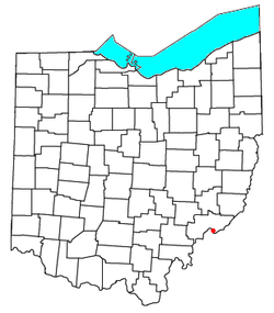
 Location of Reno, Ohio Location of Reno, Ohio | |
| Coordinates: 39°22′28″N 81°23′37″W / 39.37444°N 81.39361°W / 39.37444; -81.39361 | |
| Country | United States |
| State | Ohio |
| County | Washington |
| Township | Marietta |
| Elevation | 650 ft (200 m) |
| Population | |
| • Total | 1,129 |
| Time zone | UTC-5 (Eastern (EST)) |
| • Summer (DST) | UTC-4 (EDT) |
| ZIP code | 45773 |
| GNIS feature ID | 2633221 |
Reno is a census-designated place in southern Marietta Township, Washington County, Ohio, United States. It has a post office with the ZIP code 45773. It is located on the Ohio River a short distance south of the county seat of Marietta. State Route 7 forms its main street. The population was 1,129 at the 2020 census.
History
Reno was originally called Jericho; the present name, honoring United States Army officer Jesse L. Reno, was adopted when at the time the post office was established. A post office called Reno has been in operation since 1887.
References
- ^ U.S. Geological Survey Geographic Names Information System: Reno, Ohio
- "Reno CPD, Ohio - Census Bureau Profile". United States Census Bureau. Retrieved September 10, 2023.
- Zip Code Lookup
- DeLorme, Ohio Atlas & Gazetteer, 7th ed., 2004, p. 81 ISBN 0-89933-281-1
- "How communities got their names". Marietta Times. February 19, 2013. Retrieved December 29, 2015.
- "Washington County". Jim Forte Postal History. Retrieved December 29, 2015.
See also
| Municipalities and communities of Washington County, Ohio, United States | ||
|---|---|---|
| County seat: Marietta | ||
| Cities |  | |
| Villages | ||
| Townships | ||
| CDPs | ||
| Unincorporated communities |
| |
This Washington County, Ohio state location article is a stub. You can help Misplaced Pages by expanding it. |