Town in Western Australia
| Oakley Western Australia | |||||||||||||||
|---|---|---|---|---|---|---|---|---|---|---|---|---|---|---|---|
 View of the Pinjarra Alumina Refinery in September 2020 View of the Pinjarra Alumina Refinery in September 2020 | |||||||||||||||
| Coordinates | 32°37′09″S 115°54′48″E / 32.619040°S 115.913210°E / -32.619040; 115.913210 | ||||||||||||||
| Postcode(s) | 6208 | ||||||||||||||
| Area | 50.6 km (19.5 sq mi) | ||||||||||||||
| Location |
| ||||||||||||||
| LGA(s) | Shire of Murray | ||||||||||||||
| State electorate(s) | Murray-Wellington | ||||||||||||||
| Federal division(s) | Canning | ||||||||||||||
| |||||||||||||||
| |||||||||||||||
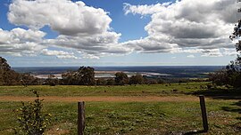
Oakley is a locality in the Peel Region of Western Australia. Its local government area is the Shire of Murray.
Oakley is located at the foot of the Darling Scarp and is very lowly populated, it is one of the locations of Alcoa's three alumina refineries, which is named after the nearest large town in the region, Pinjarra.
References
- "SLIP Map". maps.slip.wa.gov.au. Landgate. Retrieved 2 August 2023.
- "NationalMap". nationalmap.gov.au. Geoscience Australia. Retrieved 2 August 2023.
- "Alcoa -- Australia".
| Cities, towns, and localities in the Peel region of Western Australia | |
|---|---|
| City of Mandurah | |
| Shire of Boddington | |
| Shire of Murray |
|
| Shire of Waroona | |
| ^* Indicates locality is only partially located within this local government area. Places in bold are the council seat for the local government area | |
| Towns, suburbs and localities in the Shire of Murray, Peel Region, Western Australia | |
|---|---|
| Major settlements | |
| Other settlements | |
This article about a location in Western Australia is a stub. You can help Misplaced Pages by expanding it. |